Restoring the Lamoille Watershed Story Map
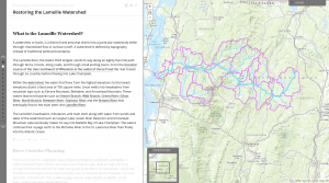
In 2015, LCCD assisted Lamoille County Planning Commission to create an online interactive “Story Map” to illustrate and explain river processes and how human activities impact the equilibrium of rivers and streams. Perhaps more importantly, the Story Map highlights the great restoration work that is being accomplished by many organizations and partnerships throughout the Lamoille Watershed.